
Let’s explore the notion that “Antarctica” is a circle of ice around the world rather than a Continent at its bottom. Let’s ask if there are undiscovered lands and continents beyond the Ice Wall, as I’ve touched on in previous articles.
The Great Wall of Ice
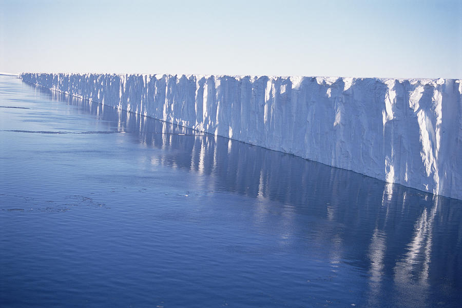
A photo of a small part of Ross Ice Shelf. If you start in Auckland, New Zealand, and keep traveling South for 3000 miles, you arrive here.

Contrary to popular opinion, the wall is found across Antarctica.
Here’s Barnes Glacier, just South of Argentina and Chile:

Some explorers find ice shelves, others find mountains.
If you start in Capetown and travel thousands of miles South, you arrive at the South African Station perched atop a high wall:

Heights of the Ice walls are reported from anything between 50 feet to 6000 feet. A map of ice-shelves:
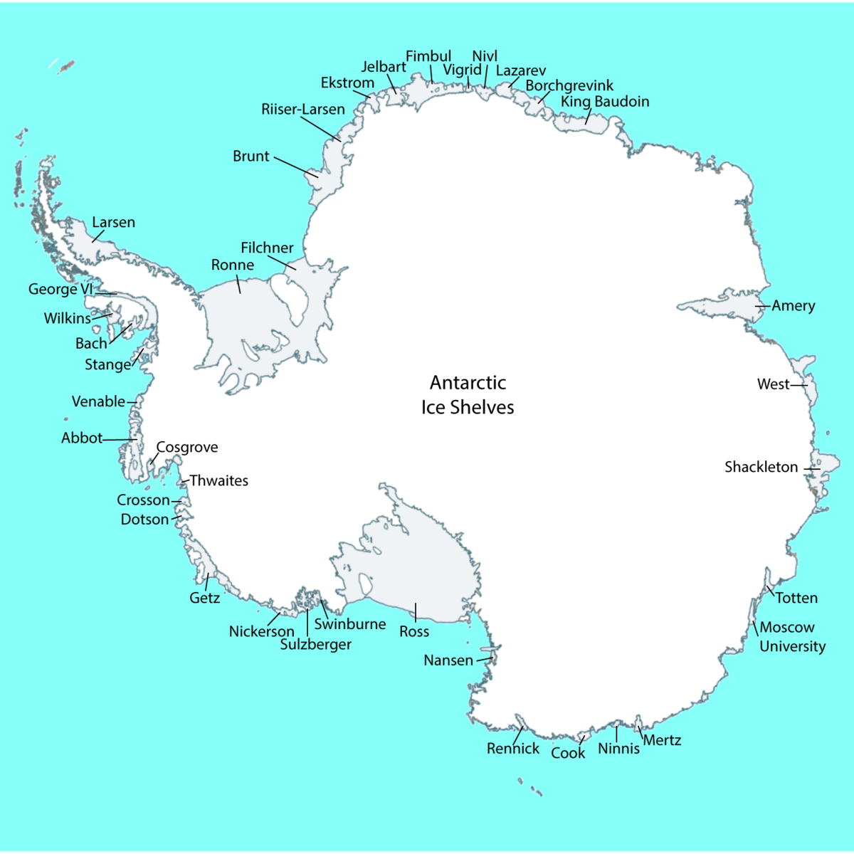
I’d like you to notice how they surround the Continent. Most people don’t know this. The public is given the impression they can take their boat to Antarctica and just start venturing inland. In reality, a massive wall separates inland from those arriving at its shores.
But before you even reach the walls, you require special permission to come close. Tourists are never led into Antarctica’s interior. Not by ship, by plane or sled. Tourists don’t come closer than the surrounding islands and the waters.
No Access
The Antarctic has a large number of ASPA.
ASPA stands for Antarctica Specially Protected Areas. A map of ASPA:
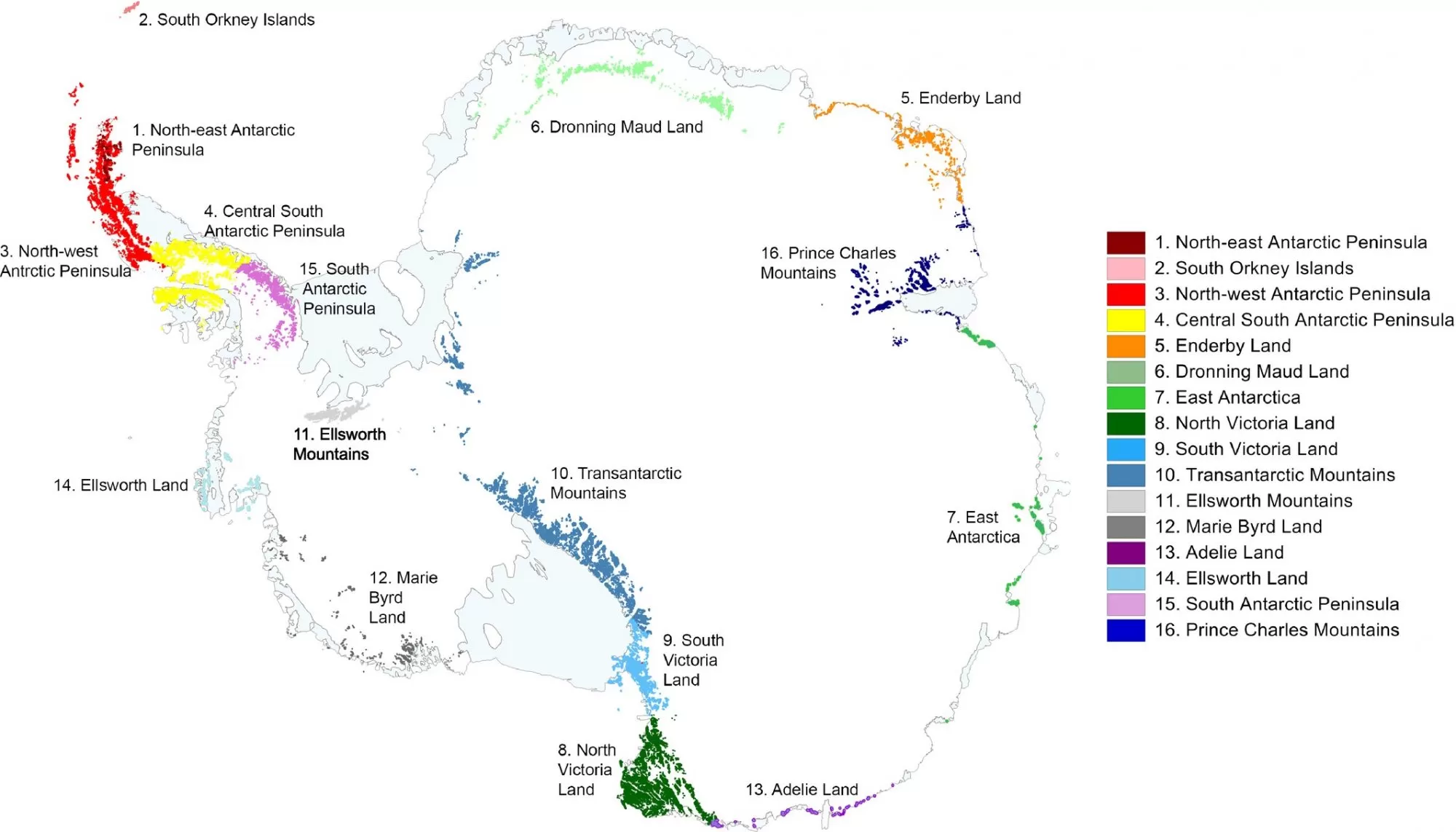
Anywhere you might access Antarctica, you’re not allowed to, even in the unlikely event that you could somehow climb the gigantic walls and mountain ranges.
In my book “Mysteries of the Arctic and Antarctic” you learned they make all kinds of excuses not to let civilians enter, even though they publicly claim “anyone” can visit.
And if ASPA isn’t enough, there are also ASMA – Antarctica Specially Managed Areas and ARA, Antarctica Restricted Areas.
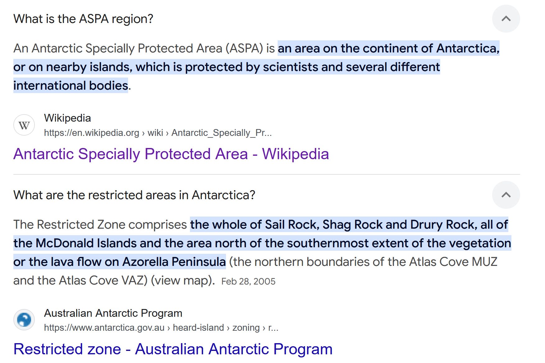
As shown in my book, the restrictions begin well before you reach the mainland. Boats and flights are routinely intercepted. Mysterious “international organizations” (that nobody voted for) make sure you never access the largest landmasses on Earth.
They won’t even permit access to “unclaimed land”. A large chunk of Antarctica is unclaimed. It is called “Marie Byrd Land”.

The official explanation of why it’s unclaimed: “It’s difficult to access”. I don’t believe this explanation. Every part is difficult to access.
What could explain this? Some say Mary Byrd Land is occupied by weaponized flying saucers operated by Nazis, Aliens or Subterranean beings. Others say Antarctica is “the seat of Lucifer”. When Governments lie, imagination tries to fill in the gaps.
It might have something to do with the real shape of Earth. Imagine stretching the Continent as in the image below. If you did that, then Mary Byrd Land would be the deep interior of Antarctica while all the “claimed lands” would be the coastal outskirts.
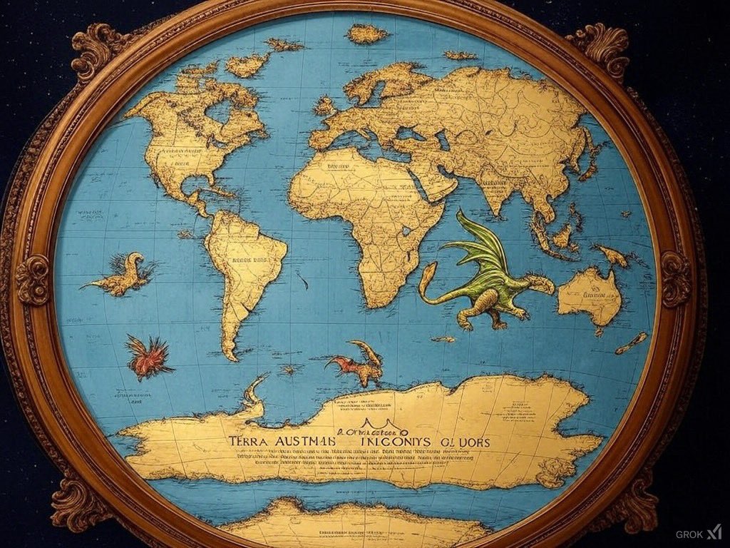
500 to 200 years ago, this was the general understanding. They used to call Antarctica the Antarctic Circle. A screenshot from the April 15, 1799 Edition of the Portland Gazette:
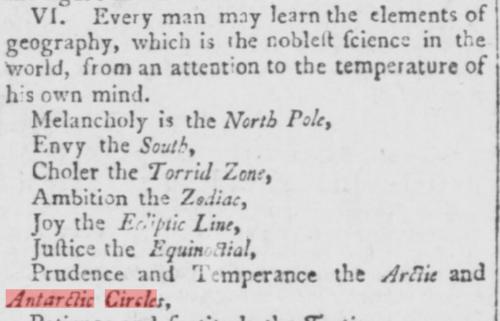
It was also called Megallanica, as well as Terra Incognita (unknown lands) at different times. On maps before 1700 it was an ice-free circle around Earth. In the early 1700s, it was suddenly “unknown” and then once again became known in the late 1700s, this time as iced terrain. Whatever disaster turned it into ice, happened around the mid 1700s.
U.S. Navy Admiral Byrd said “There is a land mass bigger than America beyond the South Pole that has never been explored”.
There is a full version of this old interview, but here’s the relevant snippet:
I won’t go into detail on Admiral Byrd because every video and article on this topic does that. I’d like my article to offer something new.
Prior to the “Antarctic Treaty” in 1959 it was common for explorers to speak of “land beyond the South Pole”. The South Pole is deep inside the interior of Antarctica and they were referring to land beyond even that. Then, in 1959 people were forbidden to go there and any such talk was discontinued. Ever since then they claim to be “studying ice” there. Guess what? 70 years later, they are still studying that ice using untold Billions in taxpayer money.
The Wall on Ancient Maps
The idea of a ring of ice around the world is the traditional view of Earth.This view only changed in recent times. I’ve shown these and other maps before, but here’s a little re-visit:


I’ve written on how this ring turned into ice in my articles
The mirror moon map and hidden continents and
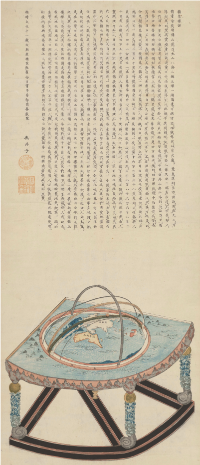
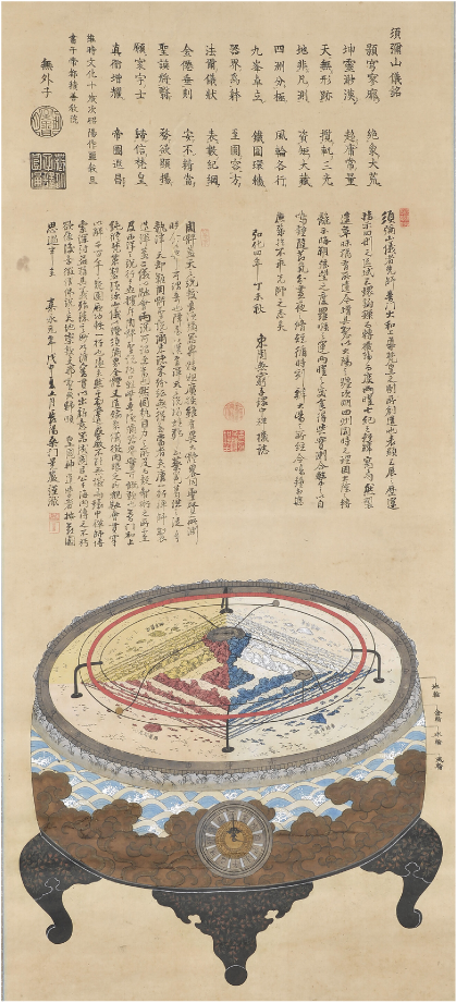
The two images here are Korean. They show the old Buddhist view of the world: Continents surrounded by a ring of mountains and made of four corners. This is precisely what the Bible and the Book of Enoch also say. See my article Antarctica in the Bible.
People argue that our view of the world changed “because we now know much more than our superstitious, clueless ancestors. We now follow the science“. But for someone like me, who has witnessed lie after lie from mainstream science, that’s not a good enough answer. If you want us to believe you, let us take flights to the south pole!
Land beyond the Ice Wall
Regardless of whether maps showing “unknown land beyond the ice-wall” are true, they allow for thinking outside of the box, beyond the confines of our belief-system.
One of the problems with this research is that the models offered sometimes contradict each other. Have a look at this one:
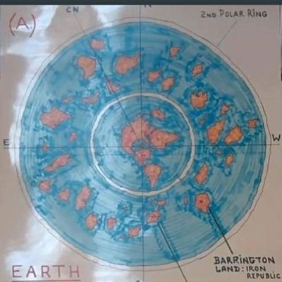
I sourced it from a Video that can be found here: What the Earth in Fact looks like as a whole.
If you’re wondering what “Iron Republic” means: In the year 1902 an article was published about a place beyond the Antarctic, discovered by intrepid explorers, called “Iron Republic’. I don’t go into detail with this story and others like it because they are written without a trace of evidence.
Compare the model above, to this one:
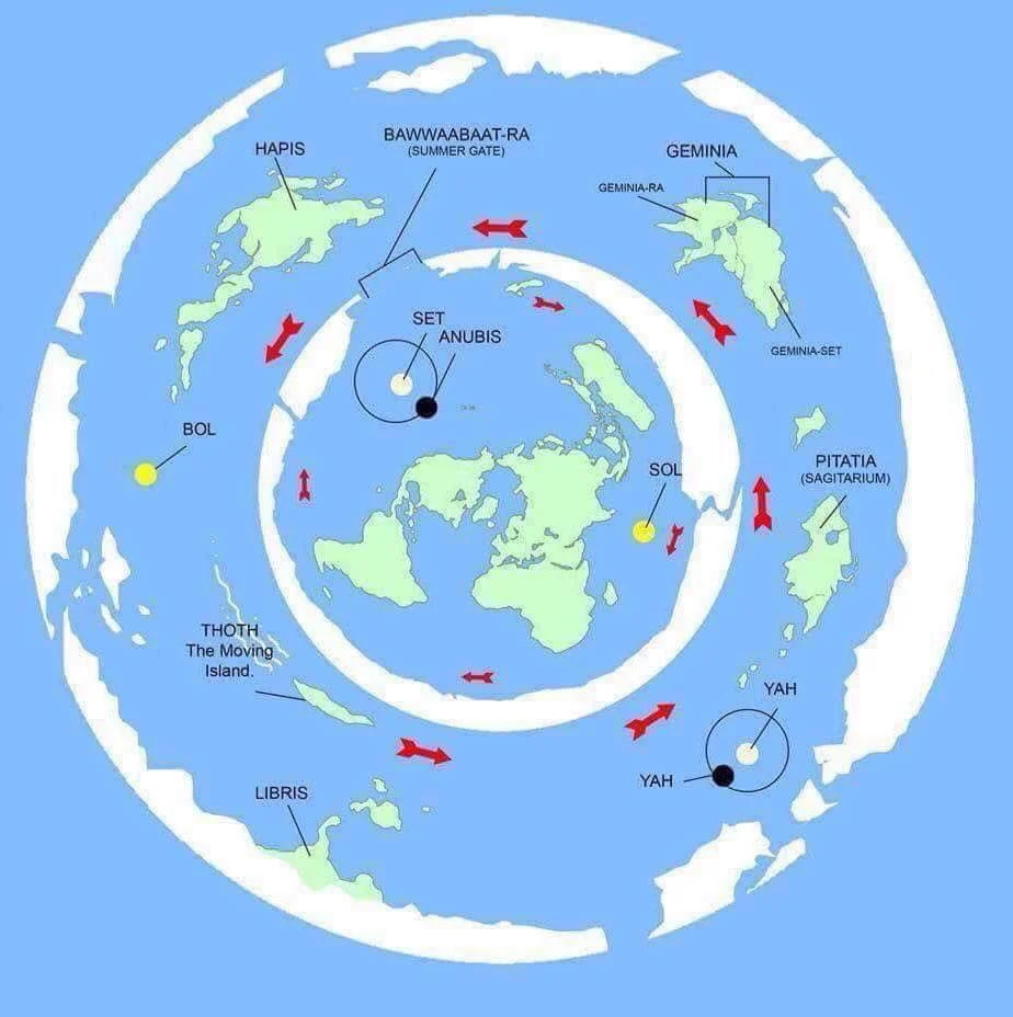
There are other models.They can’t all be true. It’s a disservice to sincere researchers that the models are presented as real on social media, often with dumb captions such as “You are not ready for the truth”.
What’s going on here? My guess is people are picking up on land beyond, intuitively. The maps are attempts to make sense of what they feel.
I owned two books about land beyond the ice-wall. One is the 1959 book “World Beyond the Poles” by Amadeo Giannini. The other is “The Navigator who crossed the Ice-Walls” by Claudio Nocelli. I couldn’t get myself to read either, beyond a little browsing, because I am bored by books that contain no specifics. If I had crossed the ice-wall and discovered strange land the very least I could do for my readers is to give them the coordinates, yes? I could tell them where I crossed the wall and where I found the land.I ended up donating the books to a thrift store. Still, both books are hot sellers, precisely because people intuitively know there is something beyond our realm.
More interesting than fictional books posing as real, are old newspaper articles. They show us that we had a completely different understanding of Antarctica.
This was published on April 4, 1897 by Wheeling Sunday Register. It is stored at the Library of Congress website.
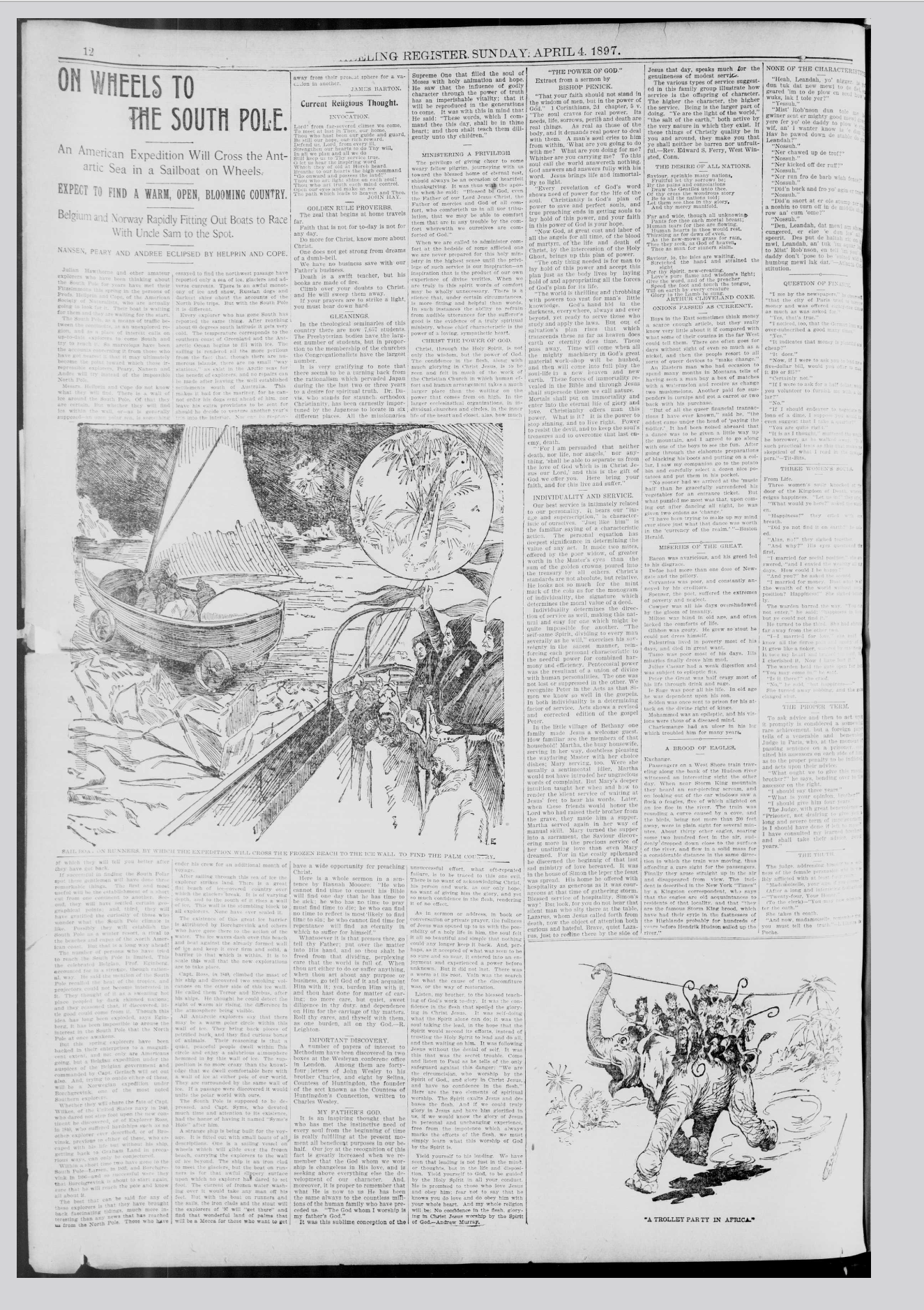
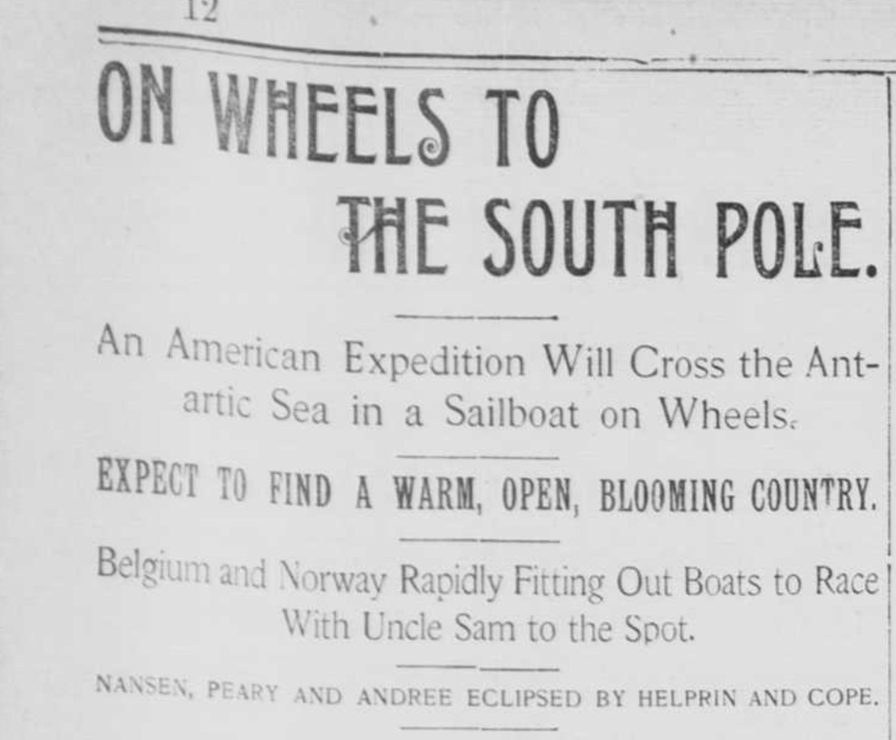
The headline informs us that explorers in those days “expect to find a warm, open and blooming country”.
But why?
According to official History, there had already been explorers to the Antarctic in the 1700s and 1800s. Word should have gotten around that it’s a barren ice-covered emptiness. 50 years later, Admiral Byrd also claimed to have found a warm climate and fertile land “beyond the pole”.
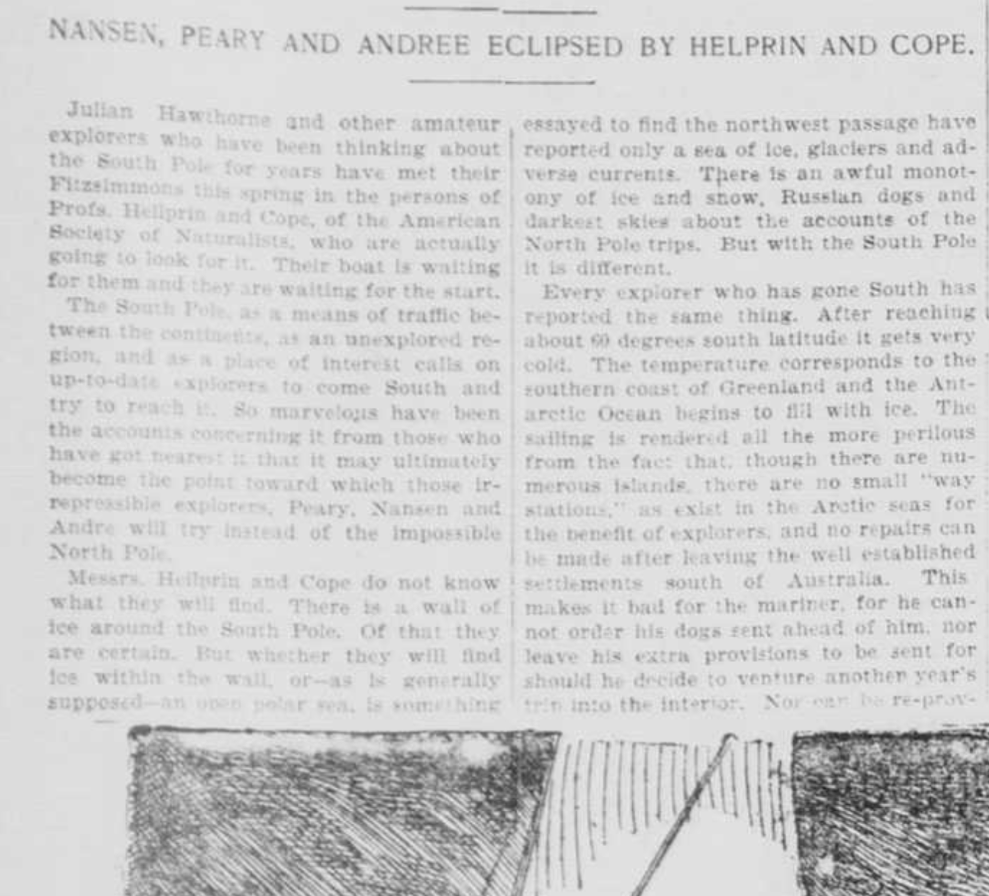
Quotes from the Article:
“So marvelous have been the accounts concerning it (The South Pole), from those who have got nearest it…”
“There is a wall of Ice around the South Pole. Of that they are certain. But whether they will find ice within the wall – or as is generally supposed – open polar sea – is something they better tell you after they got back”.
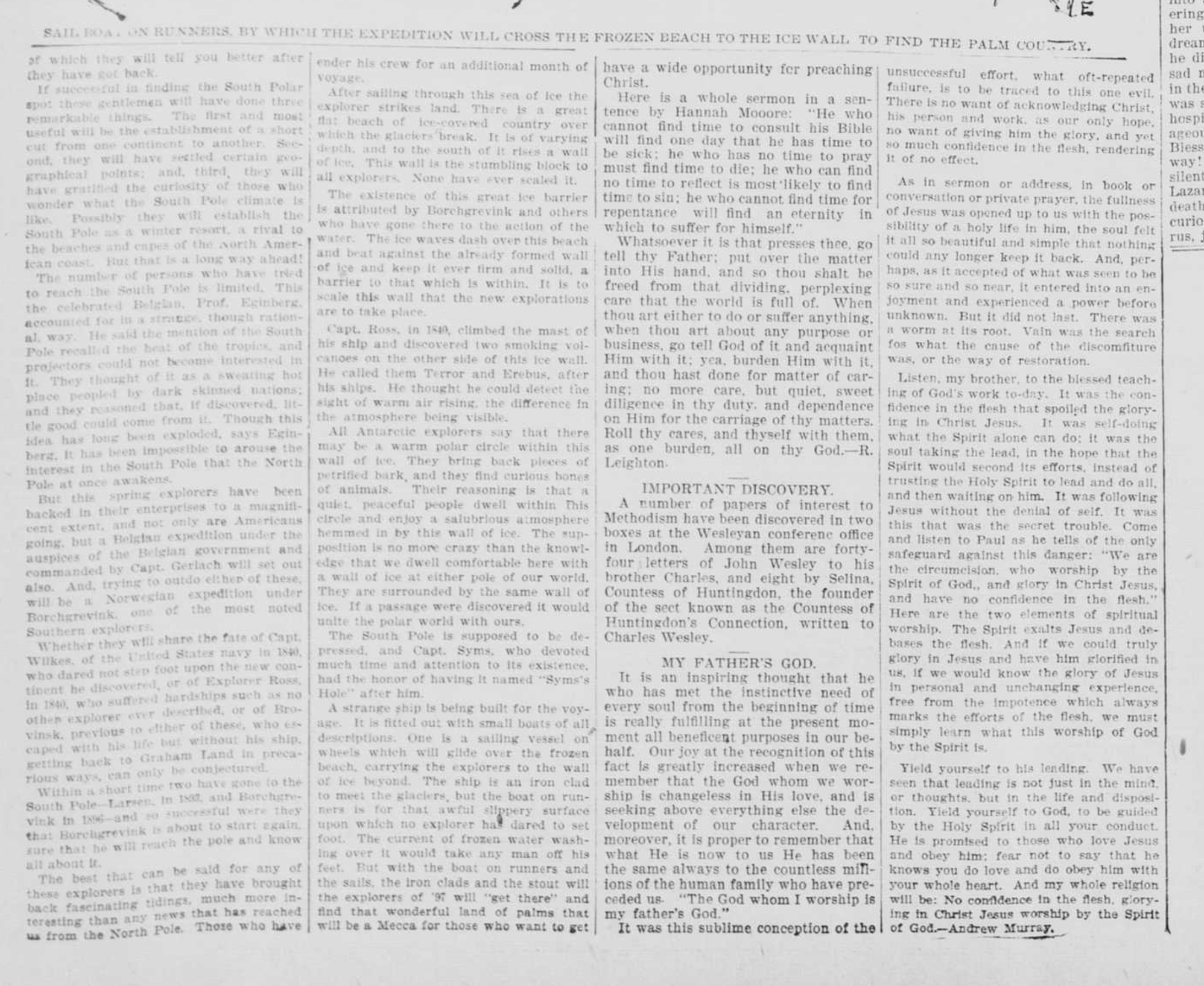
“…establish the South Pole as a winter resort, a rival to the beaches and coves of the North American coast”
“…south pole recalled the heat of the tropics”
“…to the south of it rises a wall of ice. This wall is a stumbling block to all explorers. None have ever scaled it”.
“Captain Ross in 1840 climbed the mast of his ship and discovered smoking volcanoes on the other side of this ice-wall…he thought he could detect the sight of warm air rising, the difference in the atmosphere being visible”
“All antarctic explorers say that there may be a warm polar circle within this wall of ice”
“…a quiet, peaceful people dwell within this circle and enjoy a salubrious atmosphere hemmed in by the wall of ice. The supposition is no more crazy than the knowledge that we dwell comfortable here with a wall of ice at either pole of our world. If a passage were discovered it would unite the polar world with ours”.
The article reflects our views only 120 years ago. This view lasted well into the 1950s, which is a mere 70 years ago. In 1930 and again in 1947 U.S. Navy Admiral Byrd agreed with other expeditions that there was a tropical climate “beyond the pole”. What was the U.S. Navy doing there? They were presumably looking for the Nazis who had been occupying a large chunk of Antarctica:

(Note: Even in 1943 Mary Byrd Land was unclaimed).
The article says that Ross saw Volcanoes “on the other side of the Ice Wall”. This is not the understanding taught today. Altered History teaches that Ross saw Volcanoes on Islands in the Southern Ocean. (See Wikipedia page “Ross Ice Shelf“). Why would they alter such a seemingly insignificant detail?
The article also refers to “many marvelous accounts” of warm lands beyond the wall and that “ALL antarctic explorers” speak of it. Who are these explorers? These accounts have disappeared from public view.
Is there a wall of Ice near New Zealand?
On my social-media account someone argued that “if the ice-wall were real, there wouldn’t be any flights from New Zealand toward the East”. That’s correct, of course. So I went to the flight radar website to capture a screenshot of a familiar view: No flights east of New Zealand. I responded to the commenter with the screenshot, thinking it would settle the conversation.

But he pointed at the lone plane going to Cook Island.
So I cropped out the section of the “ice-wall Earth” model above, to show that Cook Island, which is not East but more North-East, is well within the realm of possibility, even with Ice-Wall:

I’ve done the trip New Zealand to Cook Island once before. And I’ve done the flight New Zealand to Los Angeles about ten times. From this I know that the trip to Los Angeles almost always goes first to Sydney, Australia, which is the opposite direction of Cook Islands. In the rare cases that there is no stop in Sydney, the plane actually heads North, through New Caledonia.
I’ve said it many times before: My international flights make perfect sense on the north-pole centered Azimuthal map (see below) and little sense on the mainstream map.
 uc
uc
On every flight from New Zealand to Los Angeles, flight attendants have asked me to close the window shades, even in daytime. Why? Is it so that I don’t start wondering about directions?
In 2018 I aimed to get a pilot’s license. I gave up on the idea when I was informed of the rigid regulations in the country. Even if you’re a casual flyer you have to file a flight-plan for every flight that ventures outside of the mainland or even just slightly above the Ocean. Every plane must, by law, be equipped with an ELT (Emergency Locator Transmitter). There is no way you’re flying without being tracked. Most of New Zealand is a no-fly zone, even though New Zealand is mostly untouched wilderness.You can’t fly above private property, above major cities, in low flying zones, in restricted areas, in military zones, in conservation and environmental protection zones, in danger areas, in marine mammal protection zones, etc. In other words: They don’t want you to fly anywhere! You have to keep a logbook that includes every little detail no matter how minor. Not keeping it will lead to your license being revoked. There are almost no landing sites for private planes. There are hundreds of other strict regulations that ultimately discouraged me from becoming a pilot in New Zealand.

If the ice-wall model were true, then the ice-wall would start right in front of south-east New Zealand, right?

I randomly went to check Marine Traffic and found a few boats or ships were we’d find the ice-wall:
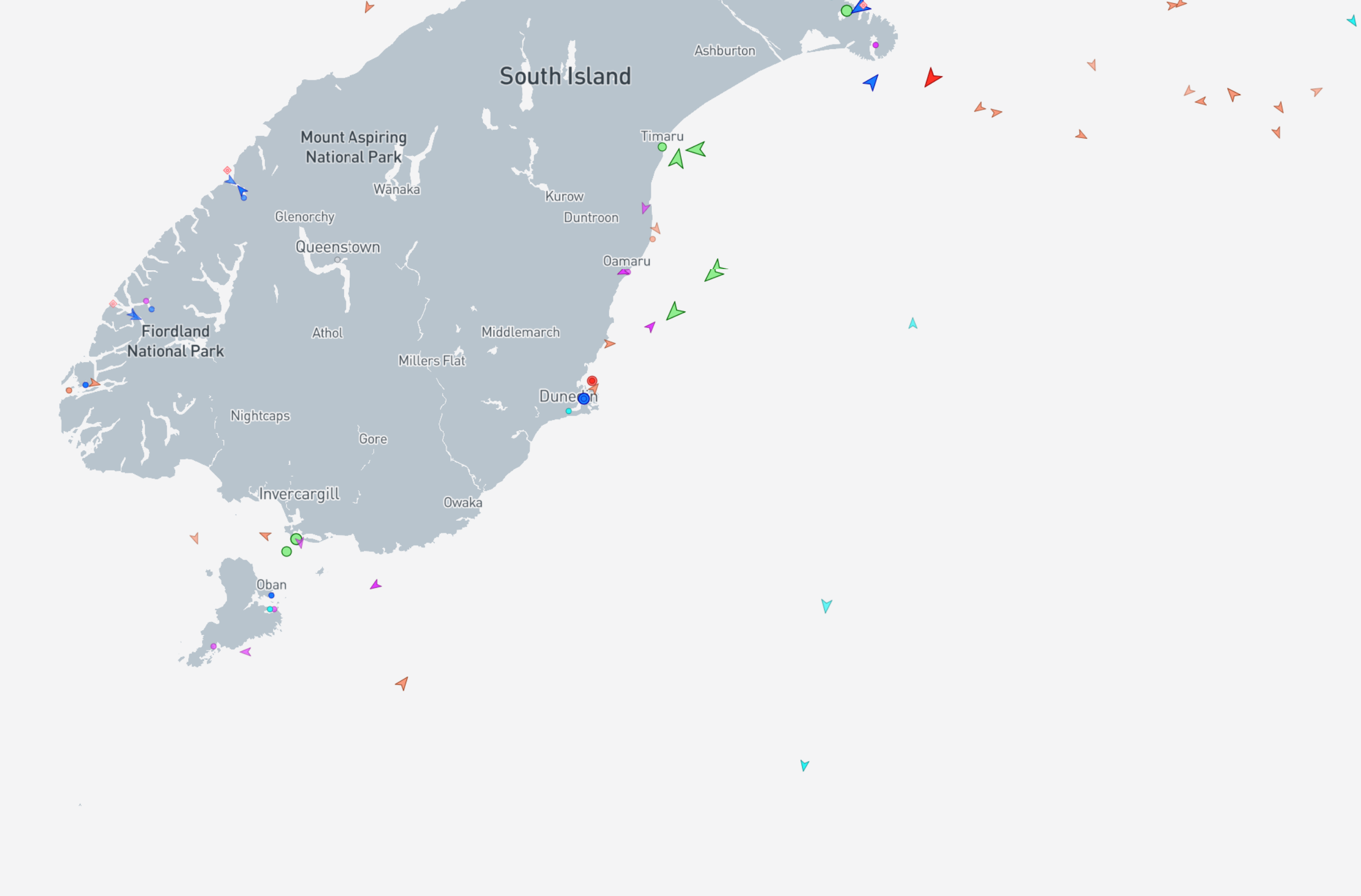
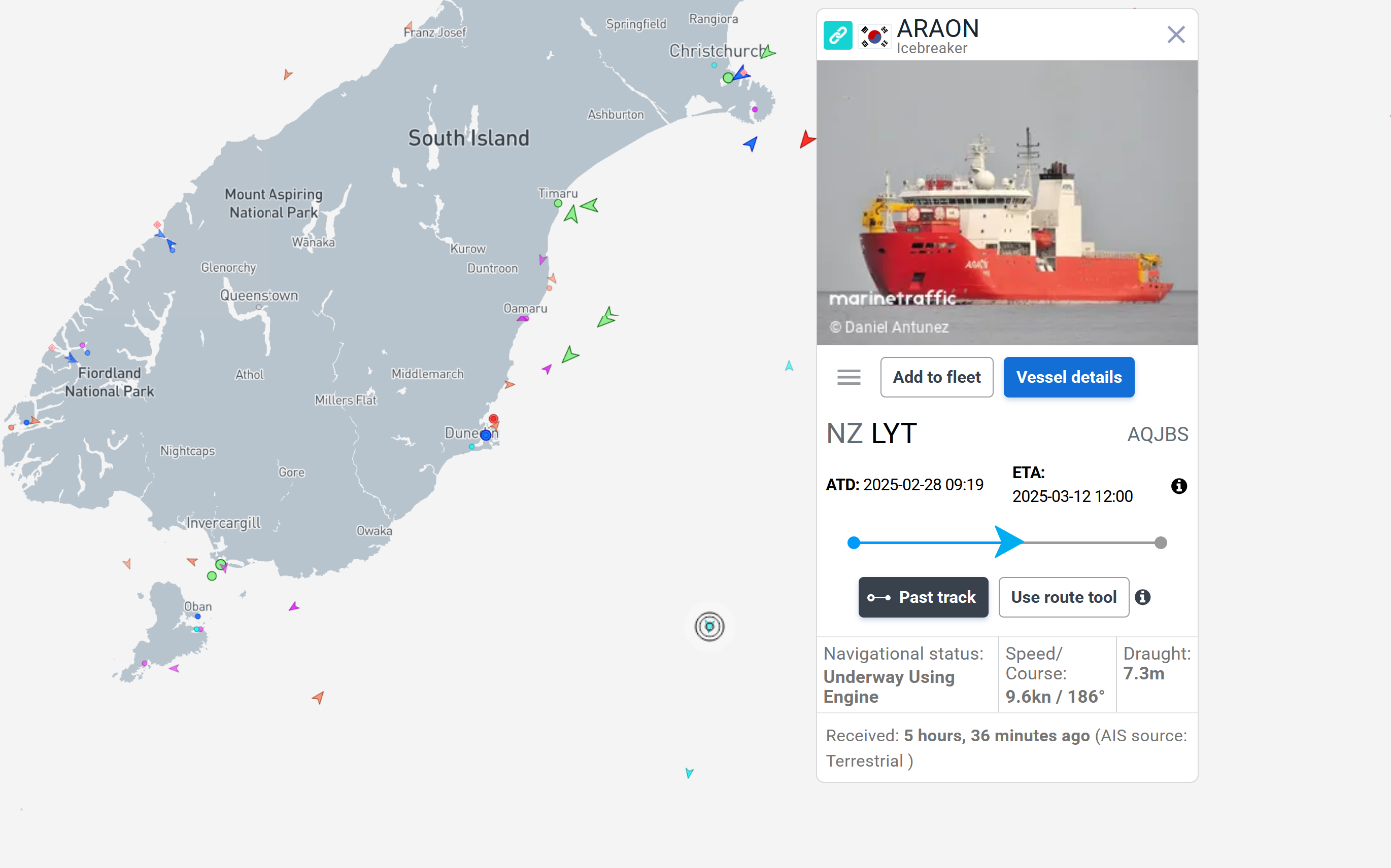
Can you see the three blue dots in the Ocean? Yeah, they wouldn’t be there if there were an ice-wall.
So…ice-wall debunked, right? Maybe. In clicking on them, I discover all three are Ice-Breakers. What are Ice-Breakers doing in the Pacific Ocean?
It is claimed that there “are no restrictions” on eastward flights from New Zealand. But in practice, that’s not true. The biggest airport in South Eastern New Zealand is Christchurch. It would be the closest city to our hypothetical ice-wall. That airport has some unique regulations on eastward flight. Every flight must be planned and announced before being approved well beforehand. As pilot you must submit precise navigation details. Small private airplanes are not equipped to fly the 8000 miles it takes to Chile when flying eastward. So small planes don’t get approved. Eastward flights require compliance with International Civil Aviation Organization standards. As far as I can tell there is only one flight from New Zealand, to Santiago, Chile that gets approval. On top of this, there are custom regulations and fuel regulations that cannot be met with eastward flights. Flights eastward are outside of the norm so they require additional air traffic approval and investigation for unfamiliar flight paths. Flights northward or westward on the other hand, don’t require the same amount of approval.
Every now and then I check for Marine Traffic in Antarctica and find a ship inland Antarctica. For example this one just a minute ago (the red dot center right where no red dot is supposed to be):
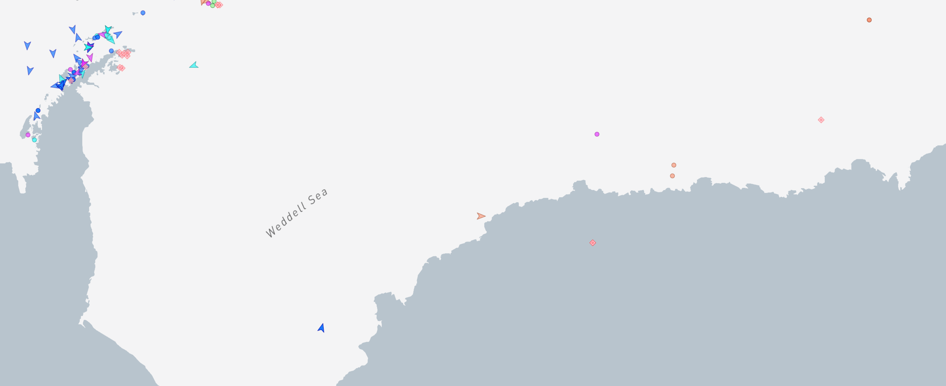
This area is beyond a place called Fimbul Ice Shelf (image below)
I have found dozens of inland vessels and in all cases no detailed information was given. Normally name, origin and destination are provided, even ownership and past History. But the ones who go deep into the secret Antarctic don’t provide you with any of that. Here’s the data on this vessel:
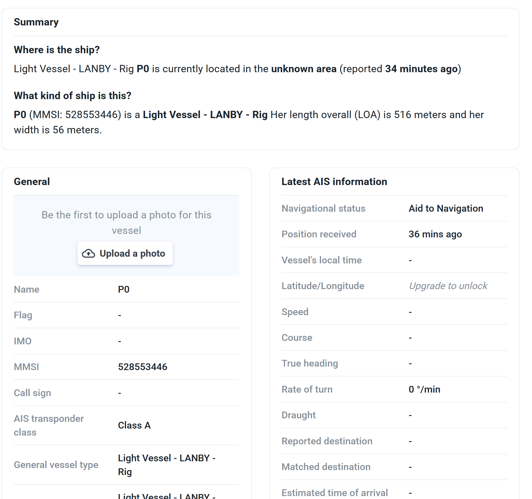
This could have a natural explanation. Maybe satellites misjudge the location.
I don’t see any rivers or tunnels on any maps of Antarctica. But come to think of it: Google Maps is extremely vague as to the topography of Antarctica. We had better maps of it a hundred years ago than Google gives us.
Going back to New Zealand, the coast of the Southern Island is known for it’s anomalies. Strange things wash up at the beach on the east side of the Island.

Yellow-eyed penguins and normal penguins periodically wash up on the eastern shore of New Zealand.
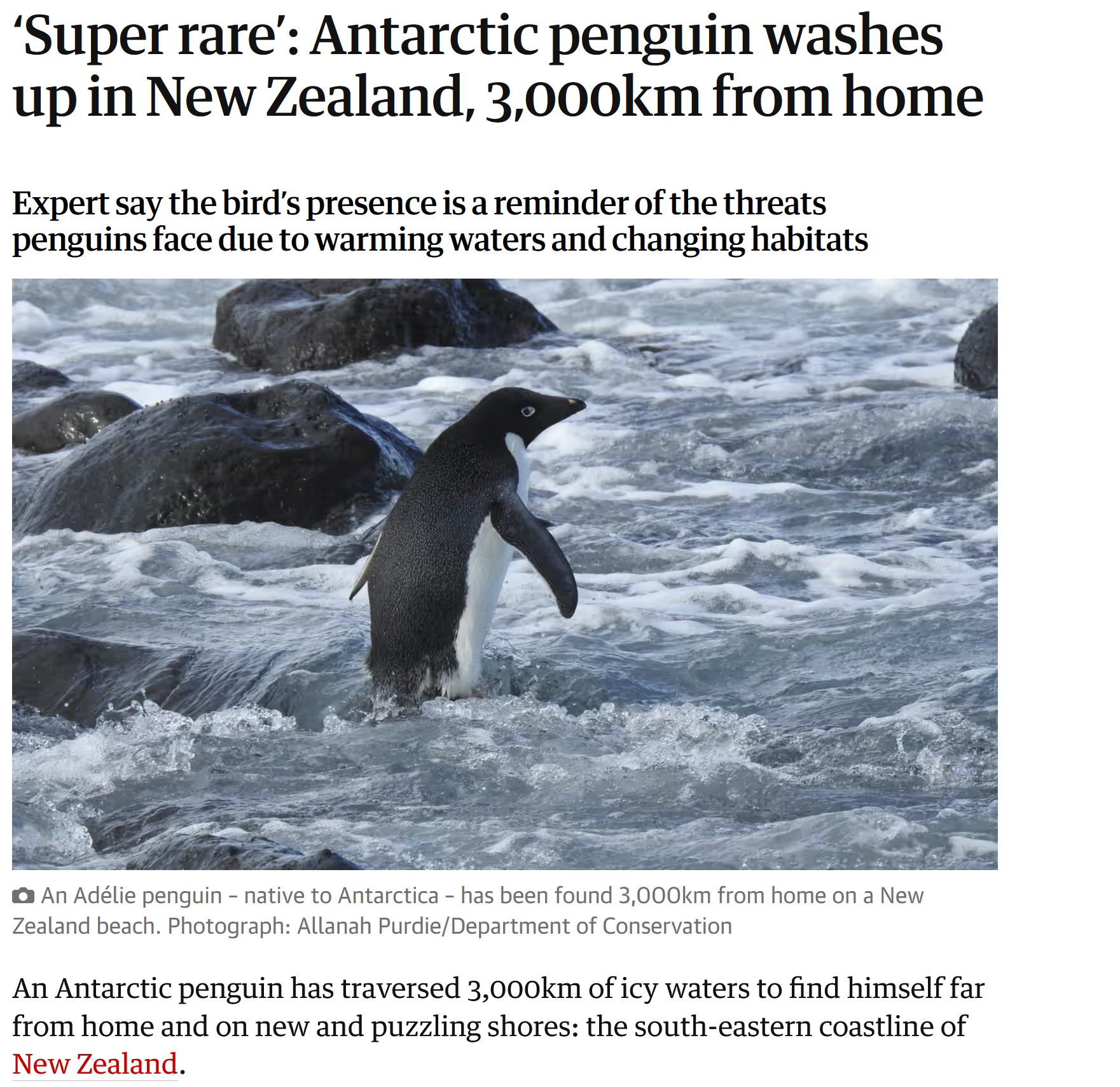
So many penguins have washed up that they are now a normal sight in southern New Zealand. We’re to believe that they washed up 3000 miles from Antarctica.
But what if the ice-wall is much closer?
If the ice-wall is real, it would probably be right where the “international date line” is.
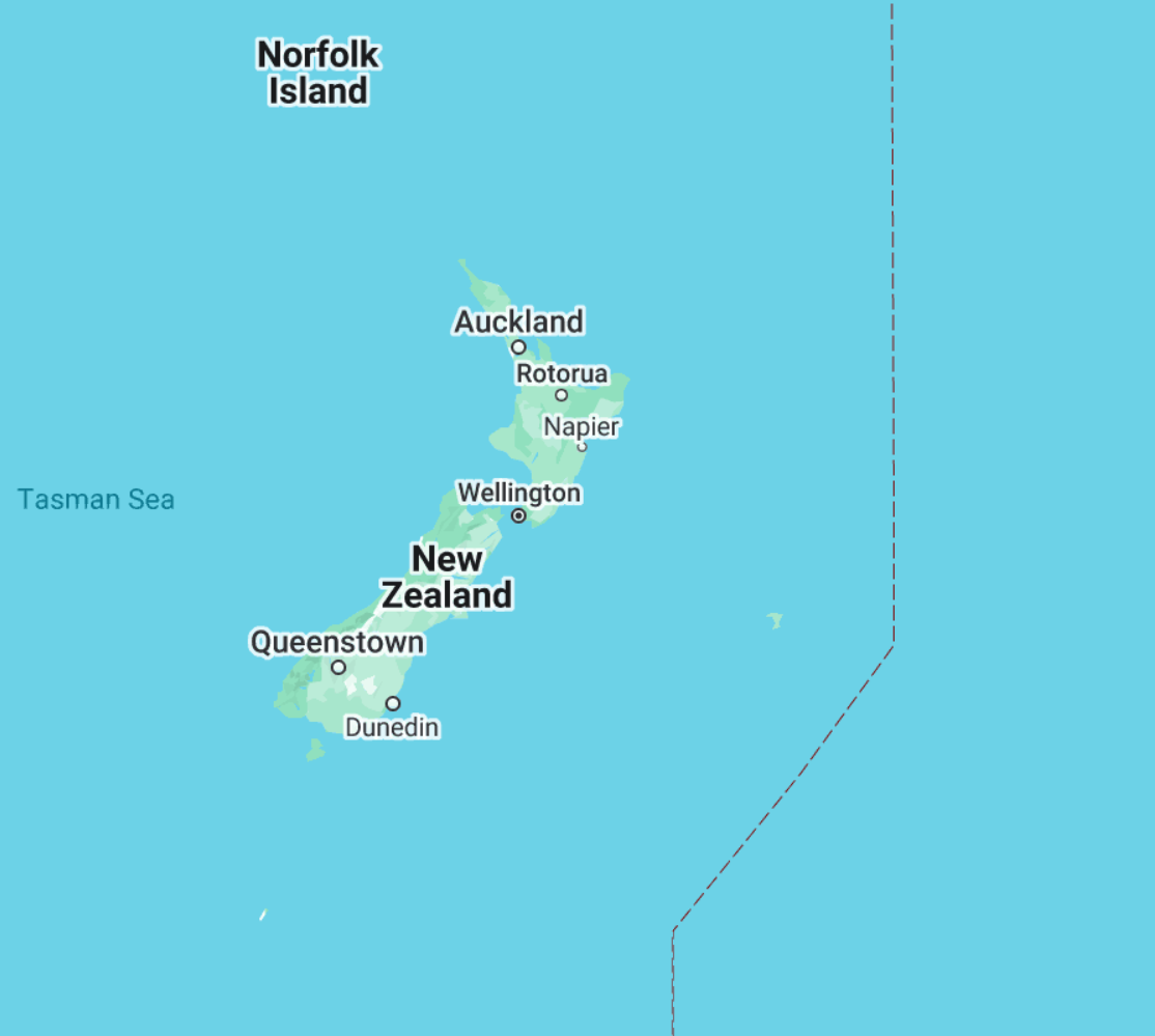
See the small piece of land near it? These are the Chatham Islands.
If our ice-wall theory is true, it would make Chatham the closest you could get to it from non-iced land. The islands are inhabited by New Zealand farmers. They look unremarkable until you dig a little deeper. People on the Chatham islands sometimes witness Icebergs floating by. One of the biggest Icebergs ever, appeared at the Islands in 2006 and made international headlines. How is that possible in a subtropical climate? From what ice-shelf do they break off? Wouldn’t they have melted on their alleged 3000 mile trip from Antarctica? FTR: Icebergs have also been viewed at New Zealand mainland.
This is not the only unexplained activity on the Islands.
* Chatham Island residents intermittently experience low-frequency hums that they describe as a faint, persistent tone similar to an engine, emanating from the ocean or ground.
* Geophysical surveys in the 1960s revealed that parts of the Chatham Rise—the underwater plateau beneath the islands—exhibit unusual magnetic anomalies. Sailors have long claimed compasses behave erratically near certain coastal spots.
* Germans attempted to purchase the Islands in 1841, a plan disrupted by the British.
* Early settlers reported finding large, mysterious bird bones on the islands—likely from an extinct Chatham species of moa or a related giant bird. By the late 1800s, these finds had vanished.
* Due to their proximity to the International Date Line and their unique UTC+12:45 time zone, the Chathams experience an odd quirk during summer: twilight lingers so late, it can feel like the sun barely sets before rising again. On the longest days, this near-continuous light creates a disorienting, almost surreal effect—time itself seeming to stretch in a way that’s subtly unsettling for residents and visitors alike.
If the Chatham Islands were directly adjacent to an unknown world, these anomalies would be precisely what one would expect.
Tunnels through Antarctica
The official narrative is that there are no tunnels through Antarctica. Any claims to the contrary have been relegated to the conspiracy-section.
Claims from various sources have the Nazis running submarine missions below antarctic ice during and after World War II. There is claimed to be a secret submarine base in Dronning Maud Land, called New Swabia (Neuschwabenland) by the Germans. An author by the name of Ladislas Szabo, in his 1947 book Hitler is Alive alleges a German submarine base that was still active after the war. In WWII the British Operation Tabarin was set up to monitor German U-boat activity in Antarctica – the British apparently believed it.
I write articles like these, to practice independent thinking. I have nothing to sell, promote or make you believe here. I believe it is possible that the shape of the Earth is different than we are told, perhaps much bigger. It is possible that there is “land beyond the ice-wall”. I consider it proven that we’ve been lied to about Antarctica (see my book). After spending a significant amount of time researching the ice-wall, I don’t think the evidence for land beyond is compelling. More data is needed before forming definite views. I wouldn’t bet money on this theory, but I hope that someday, with more information coming to light, we learn more.